


Farakka Barrage: Analysis and Recommendations for Bangladesh

Dr. Engr. Md. Zakir Hossain Khan
Farakka Barrage, a curse for North Bengal, Bangladesh. Construction of the dam began in 1962, and construction was completed in 1970. For some unknown reason, there was no protest from the Pakistan government during the construction of this death trap in Bangladesh.
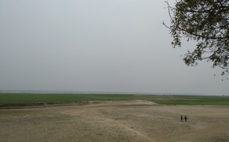
At the time of the barrage's planning and construction, East Pakistan had limited political influence within Pakistan's central government. The concerns of the eastern wing may not have been prioritized by the West Pakistani leadership, which dominated the political landscape. The dam is located in Murshidabad district of West Bengal, India. By constructing the dam, the flowing Ganga water was diverted to the Hooghly River. Water is nature's resource, here nature is restricted. After the Ganges River entered Bangladesh, it was named Padma, which is almost dead today! As a result, today the people of the banks of the Padma River in Bangladesh are suffering from drought. But what are we, the Bangladeshis, doing to survive this drought! In the last few decades, we are making a fuss because we are not getting water at the international level! However, beyond this, it is necessary to take some effective steps regarding water across the Barendra region.
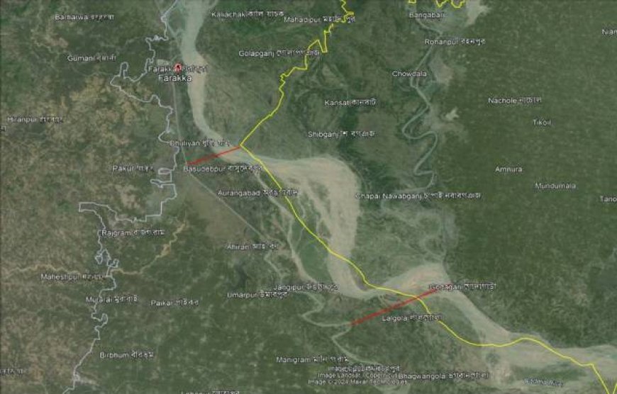
India's Hooghly River joins the flow of our fair water rights, but not far from the largest Rajshahi District in North Bengal! As seen in the map below, Shibganj in Bangladesh is about 8 km from Basudebpur part of India. Godagari of Bangladesh is about 16 kilometers away from the part of the water flow of Lalgola in India! We need to know the details amount of underground water! Hydro geological study is necessary for this. There should be a map on the current groundwater. We have to know what we have, and what we are wasting! We know that water flows from top to bottom. However, it is important to know the amount of groundwater, its extent and the extent to which it is being recharged.
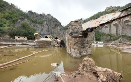
Floods mainly occur in the country from upstream water. Possible period of flood in different rivers of Bangladesh alternately from March to September. And in the Padma River, the water starts to rise towards the end of the year, i.e. between July and September. In the largest Rajshahi region, this water rises up to 20 meters. Barendra region on the banks of the Padma in North Bengal is water-deficient throughout the year due to the Farakka Barrage. Farakka Barrage is opened from India every year in July/August when floods occur for upstream water in parts of India. As a result, the dead Padma briefly returns to life. If we can store a small amount of this temporary water in the interior of the country, it may be used for agricultural purposes during the drought season, even if only a little, and the pressure on the groundwater will be reduced. In this case deep reservoirs have to be dug in abandoned lands in Barendra region, and it is not one or two; there will be thousands. And the reservoirs will be divided into several clusters. Deep reservoirs within each cluster will be connected to each other through drains/pipes. Each cluster will be separately connected to the Padma River to conserve water from July to September. Rainwater will also be stored in these reservoirs during the monsoon season, that will be useful for rain water harvesting. But it must be a deep-water body, not a shallow water body for fish farming, which will not help in conserving water.
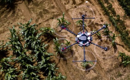
Then come with hydro geological study. It is needed across the Barendra region. With an extended hydrogeological study, GIS maps will be prepared with the depth and probability of groundwater, and regular monitoring is required. By this experiment we may be able to take some measures on the surface of our country, that our underground water will be properly preserved. We are aware that the Padma River flowing in our country is not very far from the Hooghly River. And groundwater is not confined to a small area. With proper and long-term testing, monitoring and research on groundwater, our problem can be alleviated, if only slightly.
In the last four decades, the water flow of the Padma River has decreased by about 30 percent and the permanent reservoir of this river has decreased by more than 50 percent. As a result, the biodiversity of the region has been severely damaged. To identify impact on biodiversity for Farakka Barrage, needs extensive research on the endangered biodiversity of the region. Finally, there is no substitute for proper research to protect our country, our future. And the research must have an outcome, which is in the public interest and not a waste of public money.
There has no alternative of dredging in the dead river Padma! Hydrogeologist can define the requirements of the depth of the Padma River. May be not less than Hooghly River to make it alive. Further study needs on it. But a hypothesis can be made. If the depth of the Padma River becomes greater than Hooghly River; that can be a challenge for India to keep Hooghly River alive in the future! We can also make a dam at the lower part of Bangladesh but that can be a suicide decision; but a hydrogeologist can define the necessity. Neighboring country India sometimes closes all gates of Farakka Barrage during dry season, and that is unethical. If there is no up-stream flow, there has possibility of excess sedimentation for an additional dam.
International law generally prohibits a country from unilaterally stopping or significantly altering the flow of a transboundary river, as such actions can have serious repercussions for downstream nations. This principle is foundational in international water law, as articulated in the United Nations Convention on the Law of the Non-Navigational Uses of International Watercourses (1997). It obligates states to use shared water resources in a manner that is equitable and reasonable, considering factors such as geography, hydrology, climate, population needs, and the impact on other states. If a country unilaterally stops the flow of a river that crosses into another country, it may violate international law, leading to diplomatic conflicts, economic sanctions, or legal actions in international courts. The affected downstream country may seek recourse through diplomatic channels or international litigation.
(Author is Assistant Professor, Department of Civil Engineering in Bangladesh Army University of Engineering & Technology, Natore. He can be reached [email protected]. Opinions expressed in this article are his personal.)
What's Your Reaction?